


Document Actions
gvSIG-Desktop 1.12. User manual
Trim Lines
The functionality provided by this geoprocess is to cut a line into sections of equal size. To access this geoprocess click on the geoprocesses that transform data and choose "Split lines". Click on "Open geoprocess" to display the following window:
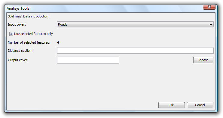
Enter the following data:
- Input cover: The Layer to be cut into into sections of equal size. You can also activate the "Use selected features only" check box to restrict the line cutting to selected lines only.
- Distance section: Enter the length of the new lines.
- Output cover: Enter the name and path of the layer for saving the changes. You can check that everything is correct by creating a field and then calculating the lengths of the new lines by means of the field calculator. Note that the last line section will not necessarily be the specified length, but will have a length less than or equal to the desired length.
Cached time 11/21/13 15:00:59 


